Saturday, April 30, 2011

259


Up to 259 reports... Good lord!

Some quick thoughts on 4/27/11


I love weather. I love storm chasing. I don't love the destruction/horror! Experiencing events like Hurricane Katrina in Gulfport, MS really shows you the true power and horror of mother nature! The images I saw in Gulfport/Bay St. Louis, MS were beyond bad, and something I'll probably never get out of my mind completely. I understand what the people of the South are going through, and I know it is going to be a long road to recovery. However, I have no doubt that the people of the South will come back stronger than ever!

Living in Starkville, MS for basically 10 years now, I have seen first hand how strong/tough these great people are. Again, just look at Katrina as an example of their amazing resiliency! It is something I have come to admire greatly! Of course this is going to be tough, as I have several friends that either lost their homes, or lost people they love. I ask everyone to help in any way they can. Any help will go a long ways! My prayers are still with everyone affected by this historic tornado outbreak!

Friday, April 29, 2011

211


Up to 211 tornado reports for 4/27/11... That's just crazy, and with a reported 318 deaths across the South, also very sad!


Thursday, April 28, 2011

Very Sad Day!


Yesterday was a very sad day for the South. I knew it was going to be bad, as this was the best setup for severe weather I have ever seen in the 10 years I have been chasing/forecasting the weather, but of course I'm shocked it was at this level. The destruction is just hard to fathom! Tomorrow, I'll write a lot more about my feelings with this event, but right now just keep everyone affected by this historic tornado outbreak in your prayers. The death toll is approaching 300 people, and unfortunately it will most likely go up. Just so sad! :-(

Wednesday, April 27, 2011

Tuesday, April 26, 2011

4/26/11 High Risk Chase!


Here are 3 pictures I shot with my iPhone today near/around Clarksdale, MS... No tornadoes, but still an amazing High Risk chase in my eyes! Great storm structure! Tomorrow honestly looks a little scary for MS/AL/TN/GA... Bottom line to me, if the surface winds stay backed SE tomorrow, which I personally expect with a 992mb surface low moving through eastern Arkansas, then look out! I'll be heading out to chase again tomorrow. Will try my best to update as much as possible on my twitter/facebook pages...


Many more pictures/videos to come later from this chase...


Monday, April 25, 2011

Great Opportunity!


Today it became official, as I'll be working with hurricanetrack.com. This is a great opportunity and I really look forward to working with this great team! I'll have a commentary block on the site, which I'll update frequently. I'll also help in other ways, including out in the field chasing/researching these amazing storms. While I love all weather, hurricanes are my true passion, and something I love to study, teach, and chase! Again, I look forward to this great opportunity as it will be a lot of fun!

I met with Mark Sudduth last week, working on the "Be Hurricane Prepared" video series. This is going to be a great video series explaining hurricane processes/safety in an easy to understand way. You see lots of preparedness information for severe weather, but you don't see this near as much with hurricanes. This is something that is needed and very beneficial in my eyes. Anything that can educate and potentially save lives is a great thing! I look forward to seeing the final product!

Sunday, April 24, 2011

One Year Since Yazoo City, MS...


Here is a link to my April 24th, 2010 chase summary, most famous for the monster 1.75 mile wide EF-4 Yazoo City killer tornado which was on the ground for an astounding 149 miles! What a crazy/sad day! Words never really do events like these justice, but hopefully my chase summary will capture some of this historic event!


Saturday, April 23, 2011

One Year Ago Tonight!


One year ago tonight, I was waiting for the day-1 to come out, thinking this was going to be one crazy/insane day! Again, I knew it was going to be bad, but I wasn't expecting a 1.75 mile wide EF-4 monster long track killer tornado that devastated Yazoo City, MS, staying on the ground for 149 miles! Here are two posts from my facebook wall that day:


2:11am April 24th, 2010: Going to try to get a couple hours sleep! Goal is to follow this probable outbreak until it gets dark... Sorry, not chasing in Alabama in the dark! If you're an inexperienced chaser PLEASE be careful tomorrow... This is not one to mess with! One mistake really could cost you your life! I'm already praying for a miracle! Be safe, be smart, and be aware!!!


‎8:38am April 24th, 2010: At the ziptrip in Hollandale, MS... Mostly clear skies! Honestly I have a very eerie feeling! Supercells forming to the west and moving into an explosive environment!


Friday, April 22, 2011

4/20 Starkville, MS Supercell


Here are three more pictures from the Starkville, MS 4/20 Supercell... Many more more pictures and video to come later!


Hurricane Video of the Day: Ivan


Hurricane Video of the Day: Hurricane Ivan - Gulf Shores, AL

Shot by Mark Sudduth

This is some amazing video from Hurricane Ivan! An Isuzu Rodeo (HIRT's old chase vehicle) was left behind to take some shots of the storm surge inside the car. To watch more videos from Mark Sudduth & to have access to some of the best hurricane information out there, I highly recommend checking out his website. hurricanetrack.com


Wednesday, April 20, 2011

The Great Plains of Mississippi!


The picture on top was shot on the campus of Mississipi State University by Ryan Hoke! What an amazing shot, as you would think this was out of Oklahoma, not Mississippi. One the better storm structure photos I have ever seen in Mississippi! The picture on the bottom was shot by myself near Artesia, MS around 6pm. It was a pretty nice wall cloud, but this supercell just couldn't drop one. It was still an amazing chase, and something I didn't expect today at all. I'll post more pictures and also some video this weekend!

Tuesday, April 19, 2011

Historic 3 Day Tornado Outbreak!


Above is the preliminarily tornado reports from April 14th - April 16th. There is no doubt this was a historic tornado outbreak, but how historic was it?

April 14th: 28 tornado reports
April 15th: 132 tornado reports
April 16th: 129 tornado reports

First, remember these are only reports. This contains several "double/triple" tornadoes and also probably some tornado reports that weren't actually tornadoes. I would personally say about 70% of the preliminary tornado reports verify as actual tornadoes these days. To the best of my knowledge, the all time 3 day tornado outbreak was back on May 28th - 30th 2004, where there were 184 confirmed tornadoes. On a side note, May 29th 2004, was the greatest tornado chase of my life, as I honestly don't know how many tornadoes I saw? LOTS! The day was highlighted by two massive wedge tornadoes I saw in Argonia, KS & Conway Springs, KS... I'll leave a link to some amazing video below!

So how does this outbreak stack up? Well, it will probably take another week or so to know for sure, but let's use the 70% verification rule for the purpose of this post.

Total 3 day preliminary reports: 289 tornado reports

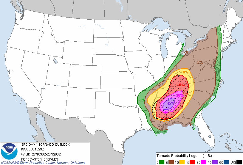
At 70%, you would get 202 confirmed tornadoes! That's amazing, and would easily set the record for confirmed tornadoes over a 3 day outbreak! Definitely historic, but let's not get too crazy with this. This was not Super Outbreak II! I don't say that in a critical way at all, but keep in mind that while I have little doubt 148 tornadoes in a 24 hours period will be broken someday, I seriously doubt you will ever see 6 F5's (today EF-5's) and 24 F4's (today EF-4's) in a 24 hour period! Is it possible, sure... But I would argue that is at least a one in a 100 year event! Plus, even then, it's not just about the total numbers, these tornadoes would have to hit enough infrastructure to obtain those insane ratings. Again, not impossible, but very unlikely! Think about it, 6 EF-5's & 24 EF-4's in a 24 hour period? Before I go, check out this really cool map made by Victor Gensini. It needs to be updated again, but it really shows you the scope of this historic outbreak!


*UPDATE* It looks like I'm going to be off with the 70% verification rate. I should have considered factors like population & the explosion of social media these days a lot more than I did! It looks to verify closer to 50%, which means the record of 184 tornadoes in a 3 day outbreak is safe. This outbreak was still historic though! On a side note, just to show how much times have changed, just look back to the May 28th - May 30th 2004 outbreak. 206 reported tornadoes, with 184 confirmed tornadoes. I know that was in the Plains, but that's still 89.3%...
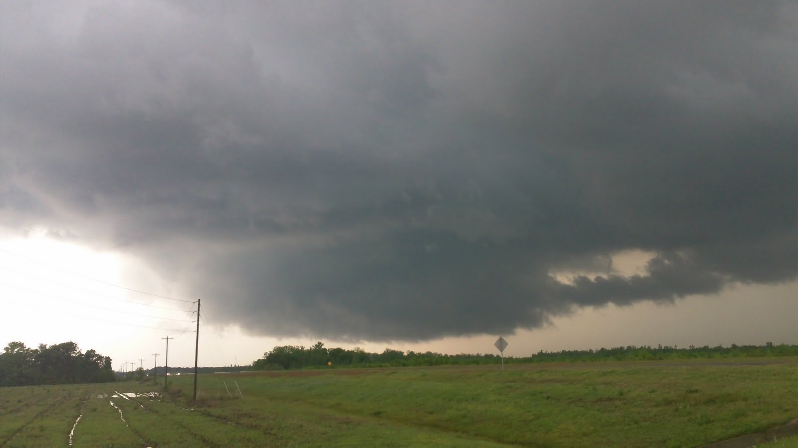
Monday, April 18, 2011

Butler, AL Tornado 4/15/11 + More!


Here is some tornado video from Butler, AL on 4/15/11... We saw at least 3 tornadoes this day, but probably more like 5 or 6. I always try to be conservative though, especially when chasing in the tress/hills of the Deep South! It's just so hard to tell/see sometimes! I have chased in the Deep South for over 10 years now, and this was the craziest day of them all... My thoughts & prayers go out to everyone affected by this historic 3 day event!


***For the other tornado videos I shot that day check out:


**My mistake! I got Butler, AL flipped with Butler County, AL... Here is some GREAT SHOTS my friend Jim Edds took of the Butler County, AL tornado: http://extremestorms.com/tornado.htm


©Copyright Greg Nordstrom 2011

ANY USE OF THIS VIDEO WITHOUT PERMISSION FROM GREG NORDSTROM IS PROHIBITED AND WILL BE PROSECUTED TO THE FULLEST EXTENT OF THE LAW!!!

Sunday, April 17, 2011

De Kalb, MS Large Tornado 4/15/11


Here is some amazing tornado video from De Kalb, MS... This is the beginnings of the large tornado that went near Scooba, MS. Many cars including a school bus was heading towards it! Thankfully, we got the school bus to turn around! We ended up following this tornado to Scooba, MS where it passed right in front of us! I have chased in the Deep South for over 10 years now, and this was the craziest day of them all...


©Copyright Greg Nordstrom 2011

ANY USE OF THIS VIDEO WITHOUT PERMISSION FROM GREG NORDSTROM IS PROHIBITED AND WILL BE PROSECUTED TO THE FULLEST EXTENT OF THE LAW!!!

Saturday, April 16, 2011

Scooba, MS Tornado (MUCH BETTER QUALITY)


Here is some better/more stable video I shot from the Scooba, MS tornado! Includes part where you can hear it coming... What a crazy/insane day! I have chased in the Deep South for over 10 years now, and this was the craziest day of them all...


©Copyright Greg Nordstrom 2011

ANY USE OF THIS VIDEO WITHOUT PERMISSION FROM GREG NORDSTROM IS PROHIBITED AND WILL BE PROSECUTED TO THE FULLEST EXTENT OF THE LAW!!!

Scooba, MS Large Tornado 4/15/11


Here is some insane tornado video I shot near Scooba, MS! I'm really sorry the video is shaky, but that's what happens in hurricane force inflow. Plus, I was trying to shoot with two different cameras... This is one of the craziest storm chases in my life! Much more video to come later today/tomorrow!


©Copyright Greg Nordstrom 2011

ANY USE OF THIS VIDEO WITHOUT PERMISSION FROM GREG NORDSTROM IS PROHIBITED AND WILL BE PROSECUTED TO THE FULLEST EXTENT OF THE LAW!!!

Thursday, April 14, 2011

Friday has a lot of Potential!


Tomorrow looks fairly big, as the key is the sun! If the prefrontal junk gets out of here and the sun comes out, then like I said, get ready! If a secondary low forms and moves through Arkansas, then we are in trouble assuming the sun is shining... Things can/do change quickly, but there is a lot of potential and it needs to be watched very closely! 0z NAM looks bad, 0z GFS not so much? However, at this point, you might as well throw the models out. All you need to do is look at the sky around 18z. Sun = Trouble! Real Observations!

*Expect the worst for Starkville around 0z... (I'll give a range of 5-9pm)

Wednesday, April 13, 2011

Calendar is clear for Friday!


Ummm Friday, yeah... I'll say this, my calendar is clear for that day!


Tuesday, April 12, 2011

Hurricane (Typhoon) Video of the Day: Omar


Hurricane (Typhoon) Video of the Day: Typhoon Omar - Yigo, Gaum

Shot by Jim Leonard

This is a classic, and probably one of the most famous hurricane/typhoon videos of all time! I have to laugh at Jim's reaction. A huge piece of debris almost hits him/his car, and all he says is *hit, and then goes right back to doing what he was doing... That's awesome! LOL!

Monday, April 11, 2011

Hurricane Video of the Day: Lili


Hurricane Video of the Day: Hurricane Lili - New Iberia, LA

Shot by Jeff Gammons

This was the first hurricane I ever chased (with Justyn Jackson, Chris Bell, & Jason Senkbeil), riding it out in Abbeville, LA. Probably saw winds gusting to around 90mph or so... In the open Gulf of Mexico, Hurricane Lili got to 145mph sustained winds before rapidly weakening to a Cat-1 at landfall. To see more of Jeff's storm chase videos and amazing photography, I highly recmmend following him on twitter (weatherzine) & checking out his website! stormvisuals.com


Sunday, April 10, 2011

Brief Thoughts - 2011 Atlantic Hurricane Season!


Here are some brief thoughts I have at this time about the 2011 Atlantic hurricane season...

Overall Numbers: Lower than last year, around 12-14 named storms...

US Impact: Higher than last year (which is very easy to do, lol), as I think we'll see at least a couple/few (2-3) US landfalling tropical cyclones...

Best Analogs: I really like 1950 & 1955! Second year/ending La Nina, with a cold PDO/warm AMO. Would also probably throw 2008 out there as well... Similar setup with a cold PDO/warm AMO. Don't like it near as much as 1950/1955 though! Really believe La Nina is going to hold on longer than most think (Cold PDO)!

US Regions At Most Risk: I'm thinking the east coast of the US (especially SC/NC) & Florida. If you throw in 2008, that would argue an enhanced threat for the Northern Gulf Coast as well...

Official Thoughts/Ideas: I'm so busy at work right now (building classes), so I probably won't come out with anything in depth until early May. I will eventually put out all my thoughts in a very detailed/in-depth post! Remember, this is just some early thoughts I have right now. Don't take this as an official forecast, as this is just my best guess! Look at last year, I said 17-20 named storms (numbers worked out well), but I was way off like most on impact! Which is really all that matters in my eyes! I will say that I do feel a little better/stronger with the analogs this year...


*IF you throw in 2008:


Friday, April 8, 2011

BACK TO BACK TO BACK!!!


BACK TO BACK TO BACK!!! After a tough fight with Penn State, I'm now 100% sure we can call this contest over! Mississippi State University did it again, as we won our third straight national championship in forecasting! Congratulations to everyone on the team for their hard work & dedication! I'm very proud of everyone! Next year we go for the 4 PEAT... LOL!

Thursday, April 7, 2011

Hurricane Video of the Day: Igor II


Hurricane Video of the Day: Hurricane Igor II - Bermuda

Shot by Michael Laca

This is some great video of Hurricane Igor, as Michael Laca shoots some of the best storm chase video out there! You can always see the time/pride he puts into his work! Michael is one of the pioneers of hurricane chasing, and I highly recommend everyone checking out his videos/website! tropmet.com


Wednesday, April 6, 2011

Hurricane Video of the Day: Igor


Hurricane Video of the Day: Hurricane Igor - Bermuda

Shot by Greg Nordstrom

This was a great chase, as I really love the island of Bermuda! I got to finally meet & chase with my good friend Devin Toporek! Also, it was great to meet all the other hurricane chasers (Michael Laca, Rob Jones, Mike Theiss, Tim Millar, Mark Robinson, and George Kourounis) out there! Would love to chase/vacation there again someday soon!


Tuesday, April 5, 2011

Hurricane Video of the Day: Allen


Hurricane Video of the Day: Hurricane Allen - Jamaica & Texas

Shot by Jim Leonard

This is some really cool video from a very powerful hurricane. At one point the pressure in Hurricane Allen got down to 899 mb near the Yucatan Peninsula! Jim Leonard is THE pioneer of hurricane chasing, and I highly recommend everyone checking out his videos/website! cyclonejim.com


Monday, April 4, 2011

Hurricane Video of the Day: Wilma


Hurricane Video of the Day: Hurricane Wilma - Miami Beach, FL

Shot by Mike Thesis

This one really pains me, as I ran out of money (still a poor college student at the time) during that crazy 2005 season! This is some AWESOME video, as I really wish I could have chased Wilma!


Sunday, April 3, 2011

Hurricane Video of the Day: Alex


Hurricane Video of the Day: Tracking the Hurricanes 2004: Part 1 - Hurricane Alex (Cape Hatteras, NC)

Shot by Mark Sudduth

While I missed Hurricanes Alex & Jeanne in 2004, I was still able to chase Charley, Frances, & Ivan. To this day, Hurricane Charley is the greatest chase in my life, as I still can't believe what we (with Josh Johnson & John Walker) experienced. Sometimes I wonder if I'll ever see anything like it again? I'll say this though, I'm going to try my very best each year until my time is up! Hoping I have at least 50 good chase years left... Enjoy the video!


Saturday, April 2, 2011

Hurricane Video of the Day: Katrina


Hurricane Video of the Day: Hurricane Katrina - Gulfport, MS

Shot by Scott McPartland & Dave Lewison

Looking back on it, I really wish I would have stayed at this location, but I rode out Hurricane Katrina (with John Walker, Richie Hoseney, & Bryce Touchstone) up the road just past where highway 49 crosses I-10...


Friday, April 1, 2011

Something Fun!


I see a lot of people post a weather picture of the day, so I thought I would do something similar. For the month of April, I'm going to post the hurricane video of the day! The Florida Keys is the theme today, as I REALY want to chase a hurricane there someday soon! I ended up posting two today... LOL! Enjoy!