Saturday, July 31, 2010

A Look Ahead...


"If" tropical development occurs out in the eastern Atlantic, I'm going to show you why I don't buy a right turn up the eastern seaboard in 7-10 days!

If you look at the ECMWF 500mb charts for Asia, I hope you notice a stout ridge extending from southern Japan through SE Asia... That says to me, about 7 days from now, you should expect a stout ridge from the Carolinas extended down into the Gulf of Mexico... Currently there is a short wave trough cutting into the ridge across the Northeast/Mid-Atlantic US... Not in the Deep South though! It's brutal, as we are expecting 100 degree weather for at least the next week in Mississippi... There are no signs of a break either across the Deep South, as the ridge will continue to build in slowly, strengthening back towards the Mid-Atlantic US...

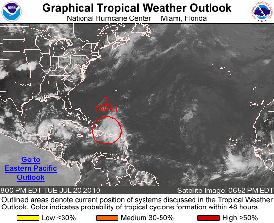
The stout ridge across SE Asia is forecasted to continue to remain strong for the next several days... So, that tells me that we'll have a similar setup across the SE US, as a "possible" tropical cyclone heads our way... The 0z GFS has come back left, but I still think it's too far right with its movement across Florida towards Apalachicola Bay! My instincts right now says a more southern track across southern Florida/Florida Straits/Cuba and into the Gulf of Mexico... It's tough to get into specifics, but again the ridge should be strong, and I don't expect a right turn up the eastern seaboard at all right now! Things can change, as smaller subtle features can put a wrench in all this! However, the overall trend should be a strong ridge across the SE US, and movement more south and west... Only time will tell, but we first have to get tropical development before this means anything besides hot humid conditions across the South!


Friday, July 30, 2010

Waiting Game...


While the tropics are about to start getting active, I still don't think the main show is coming until the MJO pulse gets deep into octants 1/2... By August 10th I think the Atlantic basin will start to explode... Think of what happens over the next week as the appetizer before the a huge steak dinner... This explosion of tropical activity I expect from Mid-August to Mid-October is not just climatology! While we may not hit the pre-season numbers many (including myself) predicted, I think an above average season is very probable... I would be shocked if we didn't end up with at least 13/14 named storms! Most importantly, I think the impact without a doubt will be above normal... We'll see what happens? I have put my ideas out, supported it with everything I know about the tropics, so if I'm wrong in the end, I'm wrong... One thing is for sure though, I'm not backing down from my thoughts/ideas until it's 100% over with!

*5 US landfalling hurricanes, with at least 2 of those major hurricanes (What's most important!)
* 17-20 named storms (Really don't like giving overall number forecasts too much!)

Thursday, July 29, 2010

90L & More!


Well it looks like things are about to get going in the Atlantic basin... The MJO, which is in octant - 3 right now, seems to be moving a little quicker towards octants 1/2... Once that happens, things should really start to get going! Octant - 3 is not horrible, but I've found that octants 1/2 are more favorable for development in the Atlantic basin (Lots of upward motion)... The "CAP" is about to break across the Atlantic basin here soon!

The NHC has two low risks areas circled... Area #1 needs to be watched closely, but 90L is the tropical wave that sparks my interest most! Area #1 should head towards the general vicinity of the Yucatan Peninsula, and eventually towards Northern Mexico/Southern Texas... 90L looks to be heading in the general direction of Southern Florida... Some of the models are fairly aggressive with development, especially with 90L... Don't trust the exact details right now, but the models are hinting strongly at development in the next few days! I think it will be a race for Colin, as I really believe both will be named eventually! I'll be all over the tropics, as we continue to watch for development!

Wednesday, July 28, 2010

MJO Octants...


Here is a segment of what Joe Bastardi posted today on the MJO octants... I figured I would post this for some more guidance on the MJO pulse, as people ask me a lot about this... With the MJO pulse moving into octants 1 & 2 in the next 10 days, I expect the tropics to pick up big time after the first week or so of August... Also, with the models forecasting easterlies in the Caribbean to decrease significantly over the next 10 days as well, this only puts more confidence in the fact that the tropics should really pick by August 7th - 10th... It's hard to put an exact time frame on it, but I think it's fairly safe to say by August 10th (latest), the Atlantic basin should start to explode! Time will tell?

"Octants 8, 1 and 2 are the places where upward motion is strongest in the Atlantic Basin. The farther the MJO line is out away from the circle, the more development is likely. It is a product of the difference of land and water temps in the equatorial areas, and when the Atlantic is warm and the Pacific cool, it tends to focus on our area of the world. In the winter, the same type of situation is associated with troughs over the eastern and central U.S., and enhanced storminess.

The circular area and Octant 4 are neutral for tropical cyclones; the other octants are hostile for development."


Tuesday, July 27, 2010

Awesome Storm Photography!


I wanted to leave a link for The Big Picture blog post on "Stormy skies"... Some amazing photography here! Enjoy!


Also, the long range models are starting to pick up on some tropical activity in the Atlantic basin! While you can't trust the details, it is at least starting to show what I believe will be an active August, especially by about August 7-10th on! The MJO should swing back deep into octants 1/2 by then! We'll see what happens?

Monday, July 26, 2010

Not about the Numbers!


1992 Season... Only one storm makes a BAD YEAR!!!


This is going to be a short post tonight, but I briefly wanted to hit on my blog post from yesterday... The main point was to show you that a top - 5 year is still very obtainable by the numbers... The statistics say it can happen, and I think a total of 18 named storms is still very possible... So while I'm not going to back down on my possible top - 3 year prediction (17-20 storms), I want everyone to understand that the overall numbers really doesn't matter! A year like 1992 proves that! All it took was one storm (Hurricane Andrew) to make it a bad year, even though there was only 7 storms (1 subtropical) overall! I've said this before and I'll say it again, IMPACT IMPACT IMPACT!!! That's what matters most! On June 2nd I wrote in my blog that I expected 5 US landfalling hurricanes, with at least 2 of those being major hurricanes at landfall... In my eyes, this is the by far the most important 2010 Atlantic hurricane season forecast I put out! While I hope I'm wrong, the impact will judge the severity of the 2010 season, not the overall numbers! For my blog post on my Forecasted 2010 Atlantic Hurricane Season Impact, CLICK HERE!

Sunday, July 25, 2010

Some Tropical Perspective!


2005 season... (1st all time) (28 named storms) (1 subtropical)

My good friend Justyn Jackson posted this on twitter today, but I wanted to pass it along on my blog as well... It puts some good perspective on this upcoming hurricane season!

In order for the 2010 Atlantic hurricane season to rank in the top - 5 all time (recorded), there will have to be 16 more tropical cyclones!

The number of tropical cyclones that have occurred after July 24th in the top - 5 most active Atlantic basin hurricane seasons are as follows:

2005 - 21 tropical cyclones after July 24th
1969 - 18 tropical cyclones after July 24th
1933 - 17 tropical cyclones after July 24th
1995 - 16 tropical cyclones after July 24th
1887 - 15 tropical cyclones after July 24th

Thanks to Justyn for this information!

Like Justyn stated on twitter, we are going to need 16 more tropical cyclones to make it to a top - 5 year (recorded)... I have never been on the bandwagon of a 2005 year, but I always thought this would likely be a top - 5 year, if not possibly a top - 3 year! In order to reach a top - 3 season all time (recorded), we are going to need 17 more tropical cyclones... Keep in mind during the 1969 hurricane season, which is 5th all time, Hurricane Camille didn't make landfall until very late in the night on August 17th... Again, just some more perspective! What's far more important is the impact to the US, which I think will be high due to the many factors I laid out over the last few months, especially the Atlantic tripole signature! Time will tell, but the statistics show 2010 can still be a top - 5 season... I expect August and especially September to be a HUGE months in the tropics! The MJO pulse will be back in favorable octants for tropical development after the first week or so of August!


1933 Season... (2nd all time) (21 named storms)


1995 season... (Tied 3rd all time) (19 named storms)


1887... (Tied 3rd all time) (19 named storms)


1969... (5th all time) (18 named storms)

Saturday, July 24, 2010

Tropical Storm Bonnie Grades!


My dog Hurricane Camille... (AKA: Category-5)


Here is a quick overview of my Tropical Storm Bonnie grades:

Short Term Track: I said Homestead to Miami Beach 24 hours out, and it made landfall in Cutler Bay, which is basically in the middle... My track was north of the NHC's short term track, and it verified very well... 48 hours + out I said what was left of Bonnie would track towards Eastern Louisiana... That also verified well... Considering I was north of the NHC's short term track, I have to give myself an A+ on the short term track!

Short Term Intensity: I thought Bonnie "might" be able to reach 50 mph tops, as it would be a weak tropical storm at landfall in South Florida... I wasn't exactly perfect here, but it stayed at a weak tropical storm at landfall... I also thought after crossing Florida that Bonnie would never regain tropical storm strength! Considering the NHC had it regaining tropical storm strength, I would give myself an A overall on the short term intensity!

Long Term Track: This one is a little hard to grade since it formed fairly close to Florida... I put out two scenarios that I believed were very possible... While one of the my scenarios was spot on, my original instincts (2 days before Bonnie formed) thought Bonnie would shoot through the Florida Straits... This obviously didn't happen, so while one of my scenarios was perfect, my instincts (second scenario) was dead wrong! That upper low really messed with me on the long term track! The best I can give myself is a B/B- here!

Long Term Intensity: Like the long term track, one of my two scenarios was perfect! However, that upper level low did trick me in the long range, so a B/B- is the best I can give myself again!

Long Term Tropical Forecasting: This is what I'm BY FAR most proud of! On July 12th at 11:29pm CDT, I blogged that I expected tropical development in the Atlantic Basin (Especially warning about homegrown development) 7-10 days out... At 11am EDT July 22nd TD #3 formed, and by 6:15 pm EDT Tropical Storm Bonnie formed... I took at little grief from some people, doubting that my 7-10 day prediction was way off since there was so much SAL & shear across the Atlantic basin... Don't get me wrong, I'm all for criticism (As long as your man/women enough to say what your thinking), but it felt good to get this one right!

If you know what your doing, following the MJO pulse is almost money back! It just proves to me that long range forecasting is possible, no matter what anybody says... I have found over the years, that a lot of people are scared of what they don't know! I personally take a completely different approach to that... I actively seek knowledge that I don't know/understand, so I can learn and become the best forecaster/meteorologist possible! I still have a LONG WAY to go, as no one is ever truly an expert in weather! I sure love the challenge though, as I try to learn as much as possible about short/long range forecasting techniques every single day! No grade necessary with this!


Friday, July 23, 2010

Bonnie is a GONER!


Tropical Storm Bonnie made landfall in Cutler Bay, FL, which was basically right in the middle of my Homestead to Miami Beach landfall forecast... Honestly, Bonnie was a dud! The highest wind gust I saw was 56 mph, 8 miles SSE of Key Biscayne at 10m elevation... There was just too much wind shear, as the upper level low never got far enough away from Bonnie to intensify... It barely was able to hold on to tropical storm status as it made landfall around 11am EDT... This wasn't much of a surprise though, as I thought it "could" maybe make it up to 50 mph tops!


Bonnie is now a tropical depression, but the NHC is forecasting it to regain tropical storm strength before landfall in Eastern Louisiana... I don't have a problem with the track, but I personally highly doubt Bonnie ever gets back to tropical storm strength! It's getting sheared to pieces by the same upper low... Plus, Bonnie traveling over the mainland of Florida didn't help matters either! Bonnie is a GONER in my eyes, as it will continue to be sheared to pieces! 50 knots of shear + dry air is NOT conducive for strengthening! I suspect the NHC will lower their intensity forecast soon! Tomorrow, I'll have my Tropical Storm Bonnie grades out! Stay tuned for that...


Thursday, July 22, 2010

Tropical Storm Bonnie!


Tropical Storm Bonnie is taking a path towards SE Florida... Winds are currently only 40 mph, and I honestly don't see it increasing too much at all... Maybe up to 50 mph tops! The same upper level low is shearing Bonnie, even though it is starting to back away slowly to the west... The more north Bonnie moves, the more the shear should slowly decrease... Why? Because it will gain more distance away from the upper level low that way... This upper level low has been "pulling" Bonnie more NW today (Creating a weakness in the ridge)... As the upper level low continues to slowly back west, Bonnie should take more of a WNW track as the ridge builds in over the top... I will say my track is more north than the NHC's track... I feel the upper level low will "pull" Bonnie north enough that I'm liking a landfall between Homestead and Miami Beach tomorrow early afternoon... I think it will be a weak tropical storm, and I don't think this is a big deal in the Gulf of Mexico! That same upper level low will continue to shear Bonnie, plus with Bonnie striking the mainland of Florida, it will continually be torn apart... I honestly don't see Bonnie ever getting stronger than 50 mph! I talked about this a couple days ago in my blog, but with Bonnie making landfall in Southern Florida, I feel its track through the Gulf of Mexico will be towards Eastern Louisiana, even with a strong ridge in place across the SE US...


Image courtesy of Michael Laca (tropmet.com)... An AWESOME tropical website everyone should check out!

Wednesday, July 21, 2010

Quick 97L Post...


97L is getting sheared apart (30-40 knots) by a strong upper level low... This was expected, as I thought 97L would pulse up and down for two to three days... The problem is I thought this upper level low would start to move out, allowing an outflow jet to develop... I really thought this outflow jet would allow for 97L to develop into a tropical storm before landfall in extreme Southern Florida... Worst case scenario, which I thought was very possible, was for 97L to more through the Florida Straits and explode in the Central Gulf of Mexico... This is now a very unlikely scenario, because the upper low is going to back west with 97L, shearing it apart as it continues its track WNW into the Gulf of Mexico... Unless this upper level low can get far enough away for the shear to relax some, I think 97L is going to have a hard time even getting named Bonnie! Even if it does get named Bonnie, this shear associated with the upper low won't allow for much development at all! Of course I'll keep watching it, but this is great news for the Gulf of Mexico!

There is a couple more tropical waves to watch across the Atlantic Basin, but I don't see anything else developing in the near future... I'm sure everyone notices the other medium chance for development in the Bay of Campeche... This is something I've been watching since last Thursday, but it's going to run out of water before it can develop into anything! I know a lot of people are a little on edge with the hyped up 2010 Atlantic hurricane season, but this is typical for July! 2004 is a great example on how things can explode quickly in the tropics! I personally believe how the 2004 season evolved, will be similar to how the 2010 season evolves! Time will tell, but I expect August to be a HUGE month in the tropics!


Tuesday, July 20, 2010

97L cont...


97L keeps getting more and more organized today, as the Hurricane Hunters will go out tomorrow to investigate 97L... This should give forecasters/models alike, a lot more information to work with! While 97L is looking better, it's still being sheared (30-40 knots) by an upper low to the north... Until 97L passes this upper low, I personally don't expect any major development... However, once 97L does pass the upper low, it should start to tap into a outflow jet, which will aid in fairly rapid deepening IMO... The question is, does it have some time, or a lot of time to deepen? Where 97L's center develops, and its early movement is key in the long range track/intensity!


If 97L were to make it into a weak tropical cyclone and strike Southern Florida, I don't think there will be much of a Gulf threat at all... It would be "pulled" further north, and even with a strong ridge in place, there wouldn't be a lot of time for redevelopment! This would most likely lead to a Eastern LA/MS long range landfall... If 97L were to make it through the Florida Straits, then LOOK OUT! In my opinion you would start to see rapid deepening, as what would be Bonnie enters the Central Gulf of Mexico... The ridge across the SE US is very strong, so I think a track towards North-Central Texas/Western Louisiana is very likely... This is a worst cast scenario, but a very likely scenario IMO! We'll know a lot more tomorrow after the Hurricane Hunters investigate 97L!


Right now I'm leaning much more towards a track through the Florida Straits! With a strong ridge in place, this makes the most sense to me! BUT, it really depends on how 97L forms into Bonnie... Where the center forms is KEY in forecasting the track! Again, we should know a lot more tomorrow, as we are in a wait and see mode right now! Everyone needs to watch 97L closely! I have been saying this for a couple of days now, but 97L is NOT something to sleep on!

Quick model overview:

18z GFDL: 55 knots at landfall is very possible across southern Florida, but I do think the track is too far north!

18z HWRF: I like the more southern track, but I think it's a little low with the intensity...

12z Canadian: I actually like this run a lot! I do think the long range track is a little too far east...

18z GFS: I think it looks pretty good in the short term, but it's struggling in the long term... Especially with intensity!

12z ECMWF: Doesn't do much at all with 97L... It that possible? Of course it is! It still has to fight off a strong upper low first, but I do think it at least gets to a weak tropical cyclone before landfall in Southern Florida...

The bottom line with 97L, the more of the Florida mainland what may be Bonnie strikes, the less of an impact in the Gulf of Mexico... Worst case scenario for Southern Florida, maybe a weak hurricane! That's a BIG maybe through, as I think a tropical storm is much more likely! Worst cast scenario if what may be Bonnie moves through the Florida Straits, is a major hurricane moving through the Gulf of Mexico... This is a real threat if "Bonnie" does move through the Florida Straits with minimal impact from the Florida Mainland... This is a very fine line I'm talking about! 50-100 miles will make a HUGE difference! Much more to come tomorrow!

Monday, July 19, 2010

97L...


Area #1, which is now 97L, is looking a little better tonight... I'm going to focus all my attention on 97L, since area #2 doesn't look so good right now... I wasn't expecting much out of area#2, but I thought conditions were favorable enough for some slow development... It still needs to be watched as it heads towards the Yucatan Peninsula, and eventually towards Southern Texas/Northern Mexico...


While 97L is looking better tonight, it still has a LONG way to go... It's contending with a lot of shear (30-40 knots) right now on the northern side of the tropical wave... The shear tendency is forecasted to lower (10-20 knots) over the southern side of the tropical wave, but still there is too much shear to the north for any serious development... I'm sure you will see 97L flare up and then flare down for the next 48 - 72 hours... However, people need to watch 97L in the long term! Once 97L passes the upper low/trough, it will start to move into a much better environment... Plus, once again, the MJO pulse is in octave 2 right now, which is statistically very favorable for development in the Western Caribbean/Gulf of Mexico... By biggest fear with 97 L, is for it to move through the Florida Straits and explode once it gets into the Central Gulf of Mexico... Don't sleep on this!


One other problem with 97L IMO, it's two tropical waves fighting against each other... The energy needs to consolidate before you are really going to see it explode... "If" the energy can combine/consolidate, as it starts moving away from the upper low/trough, the shear will relax and conditions should start to become favorable for development! South Florida needs to watch 97L, but again my biggest fear is 97L moving through the Florida Straits and exploding in the Gulf of Mexico... It "could" strike southern Florida as a weak tropical cyclone, but I don't think it have enough time to really get its act toward before landfall... The worst case scenario is for 97L to take a path through the Florida Straits and out into the Gulf of Mexico... This is a very real threat that everyone needs to keep an eye on! Until it develops, I'm not very worried, but again don't sleep on this!


The 12z Canadian takes 97L into the Central Gulf of Mexico... It develops it into most likely a hurricane, and takes it towards the Mississippi Coast... In reality, it's hard to put a lot of stock in the Canadian... It has a problem with overdeveloping most systems in the tropics! Plus, as I stated last Wednesday, the ridge across the SE US will stay strong, so I'm NOT buying a northward turn at all... The 18z GFS takes 97L into the Central Gulf of Mexico, but never really develops it into much... The 12z ECMWF takes 97L into South Florida, and never develops it into much of anything in the Gulf of Mexico... The 6z GFDL doesn't do much with 97L, but the 6z HWRF develops 97L once it gets into the Central Gulf of Mexico... With some model support for a Gulf of Mexico threat, everyone should watch 97L very closely over the next several days! I know I will...

Sunday, July 18, 2010

Tropics...


Tomorrow, I'll have a much more detailed blog post on the tropics, but I wanted to at least touch briefly on the NHC's tropical weather outlook... The NHC has circled two low risk (10%) areas for development... Both need to be watched, but I'm going to focus mostly on area #1... It has made it through the SAL, but now it's contending with a lot of shear (30-40 knots)... The NHC was talking about some slight pressure falls with area #1, but until the shear gets out, don't expect much development! Once it passes the upper trough/low, there is some room for development as it approaches south Florida... I'm not overly excited right now, but both the Canadian/GFS show some weak development... The 12z Canadian shows some weak development as area #1 approaches south Florida, and the 18z GFS takes area #1 through the Florida Straits with some weak development in the central Gulf....


Area #2 looks to take a similar track Hurricane Alex took... The 12z Canadian tries to develop area#2 into a weak tropical cyclone before landfall in northern Mexico 138 hours out... Area #2 is in a good region for development (little to no dry air/shear), so it's something to watch without a doubt... Again, with the ridge holding strong, this looks to be a Northern Mexico/Southern Texas threat... I want to watch it develop first before I get excited... Remember, the MJO pulse is in octave 2, so the environment in the Western Caribbean/Gulf of Mexico is statistically very favorable for development...


Saturday, July 17, 2010

Northern Georgia Continues...


I'm having a great time in Northern Georgia! Beautiful area... I'll get back to the tropics tomorrow when I get home, but here are 13 more pictures from some great places all across the US... Enjoy!


© Greg Nordstrom 2006-2010...

Friday, July 16, 2010

On my way to Northern Georgia!

Going with another 13 picture blog post in honor of my trip to Northern Georgia... Here are 13 pictures of myself from California (Mammoth Mountain) to Florida (Key West)! No captions necessary... Enjoy!


© Greg Nordstrom 2007-2010